
2,100 km of Cyprus Trails: How I Built a HAT
There is a fundamental problem with looking for motorcycle trails on a map.
They all look brilliant!!!
A thin line disappears into the mountains, joins another thin line somewhere near the top and eventually emerges 30 kilometres later beside a village. On the screen it looks perfect. You start imagining sweeping gravel, pine forest, spectacular views and perhaps a conveniently positioned taverna at the other end.
Then you go and ride it.
Sometimes it’s every bit as good as you hoped. Sometimes there’s a locked gate after four kilometres, the track has ceased to exist, or it deposits you in somebody’s goat shed. And sometimes you ride the whole bloody thing only to discover that it was, frankly, a bit shit.
That, in a nutshell, is how the Horizon Adventure Trails — the HATs — came into existence.
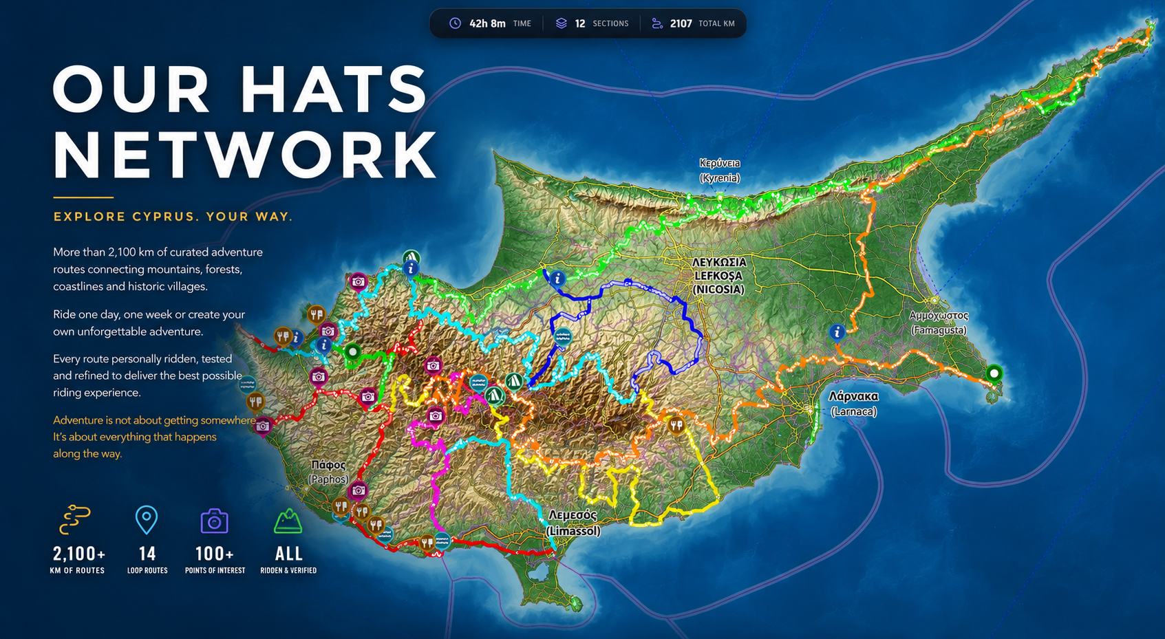
Today there are roughly 2,100 km of HATs across Cyprus. They’re free to download and ride, but the number doesn’t really tell the story. The more interesting figure is the amount of Cyprus I had to ride to find those 2,100 km.
And I genuinely don’t know exactly what that number is. But it’s a lot more.
It actually all started in 2018
I’d been riding adventure bikes in Cyprus for years before the HATs existed, doing what I suspect most people who enjoy exploring eventually do: looking at maps, wondering where things went and building my own collection of routes.
I already had more than 1,200 km of Cyprus trails mapped for my own riding by 2025, and one day I went looking for the Cyprus section of the TET.
There wasn’t one.
So I stuck my hand up last year and set about building the original framework for the Trans Euro Trail here. Having 1,200 km of previously explored riding was obviously a fairly useful starting point, but a TET route and a personal collection of trails aren’t the same thing. The route still had to work as a coherent journey through the country, which meant considerably more exploring, joining, rejecting and rerouting.
Six months, five or six days a week, two bike services, three sets of tyres and four broken ribs, to be precise. Two broken ribs twice, if one were being pedantic. I never said I was Mario Roman, did I?
Anyway, that process taught me something which eventually became fundamental to the HATs:
Finding tracks is easy. Finding tracks worth riding is harder.
The interesting bit usually starts when the plan goes wrong
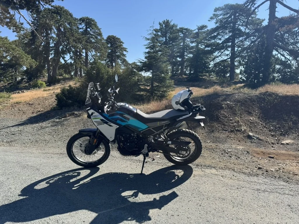
My normal approach became fairly simple. I’d identify an area that looked promising, create a rough route and go exploring.
Sometimes I’d get 50 kilometres into it before discovering the problem. Sometimes I’d get 500 metres. Turn around, find another way, try the next track, discover that doesn’t work either and backtrack again.
Occasionally, what looked like the obvious route on the map was dreadful and the insignificant little line beside it turned out to be fantastic.
Those are the days I enjoy.
I’ve always liked exploring more than simply following somebody else’s GPX. There’s something deeply satisfying about reaching a junction you’ve never seen before, looking at three tracks and thinking, Well, one of these must go somewhere.
Admittedly, sometimes none of them do.
But that’s part of it.
Eventually all those successes, failures and U-turns became the original framework for the Cyprus TET. It was something I was enormously pleased to have contributed to, but it also reinforced something I already knew from years of exploring here.
There was an awful lot more riding out there.
The HATs Philosophy
The TET has its own rather wonderful purpose and philosophy. I have a slightly different perspective, so there came a natural junction where it was sensible to leave it in other people’s capable hands.
I’m still immensely pleased that I put my hand up, and I met some incredible volunteers who wanted it built too. But I also carried on doing what I’d been doing long before the TET was conceived here: exploring Cyprus on a motorcycle.
Only now I had a different question.
I wasn’t trying to create a single route through the island.
I wanted to know:
What are the best trails in Cyprus if you don’t have to make them fit into one continuous line?
That’s really where the HATs began.
A network gives you a different kind of freedom
A route through a country has to connect one place to another. However interesting you make it, eventually geography wins and you have to get from A to B.
The HATs don’t have that problem.
A fantastic trail that loops into the mountains and eventually brings you back somewhere near where you started might be completely useless if your objective is to cross Cyprus. It can still be a bloody brilliant day on a motorcycle.
Once I stopped thinking about a route across Cyprus and started thinking about a network for riding Cyprus, things became much more interesting.
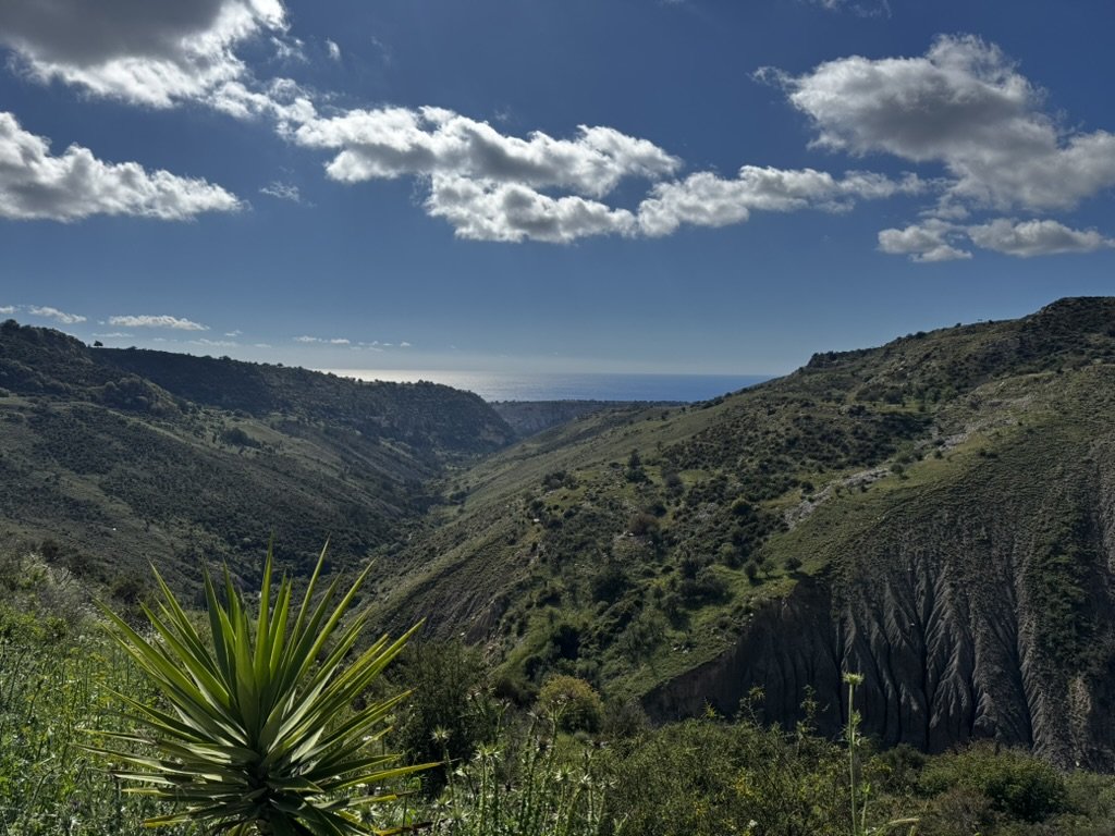
I found tracks heading towards the coast, routes through forests, long flowing mountain sections, rocky climbs, river crossings and easy trails through vineyards and orchards. I found sections that were considerably harder than I expected and plenty that I rode once and felt absolutely no desire ever to ride again.
I had one memorable day in February when I managed 13 river crossings in a single morning, some of which left me with an extremely high-pitched voice.
The question was no longer “Does this help me get across the island?”
It became:
“Is this worth riding?”
That’s a much better question.
More kilometres isn’t necessarily better
It would have been very easy to make the HAT network enormous.
If the objective had simply been to advertise the biggest possible number, I could have included almost everything I’d ridden and claimed several thousand kilometres of adventure trails.
But that’s not particularly useful.
A GPX file isn’t good because it’s long. It’s good because somebody riding it has a good day.
So I started throwing things away.
Tracks that went nowhere useful went. Tedious sections went. Routes that duplicated something better nearby went. Sections where access had become questionable went. And occasionally perfectly rideable tracks went simply because I knew there was something better.
That is probably the most important part of the whole HAT project.
The HATs aren’t a record of everywhere I’ve ridden. They’re the bits I thought were worth keeping.
Today the published network is roughly 2,100 km. In creating it, I’ve probably ridden something like half as much again, although I stopped counting a very long time ago.
Some of the rejected kilometres were terrible.
Some were perfectly fine.
They just weren’t good enough.
Not every HAT is supposed to be difficult
There’s another temptation when building adventure routes: believing that harder automatically means better.
I don’t agree.
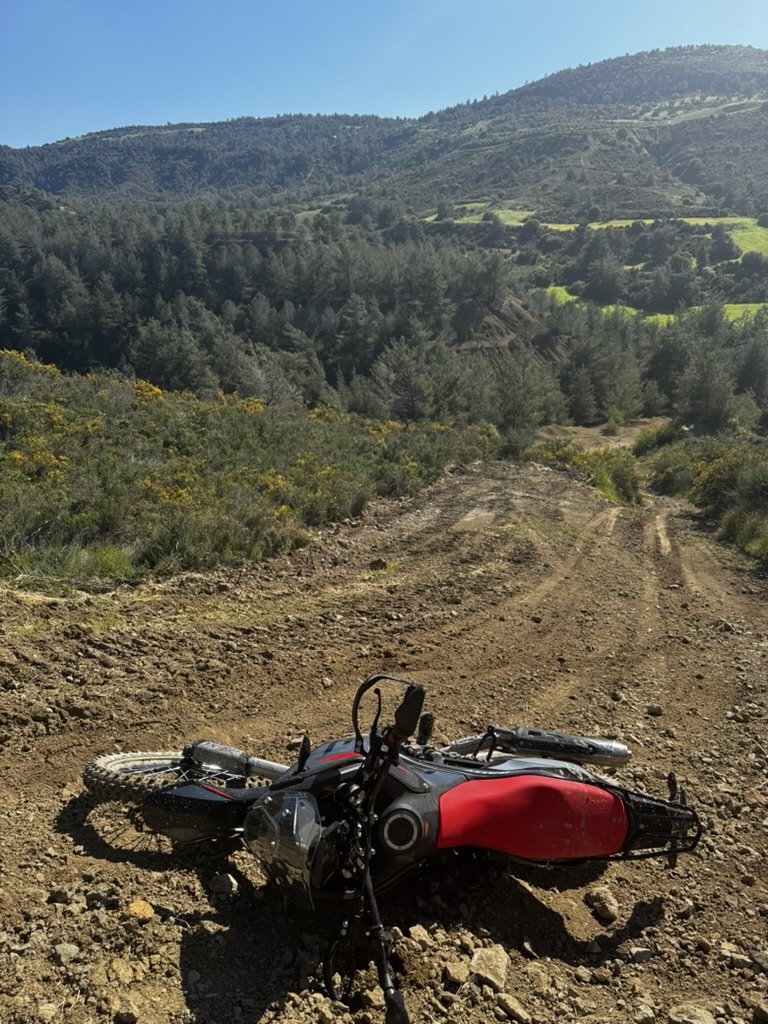
Some of my favourite riding in Cyprus isn’t particularly difficult at all. It’s a flowing track through a forest, a long climb with a ridiculous view behind you, or a trail that lets you relax and enjoy the motorcycle rather than spend the next hour trying not to drop it.
Elsewhere, there are sections that demand considerably more attention.
The point isn’t to force everybody through the hardest thing I can find. The point is to give riders choice.
If there’s a technical section worth riding, I want people to know it’s there. If there’s a sensible alternative, I want them to know that too.
Somebody on a lightweight enduro bike may look at a rocky climb and think yes please. Somebody riding a loaded 230 kg adventure bike may make a different decision.
Neither is wrong.
The HATs are intended to help you find your ride, not prove anything to anybody else.
Cyprus doesn’t stay still
Publishing a GPX file doesn’t freeze the landscape.
A track that’s completely straightforward in October can be a very different proposition in March. Rain moves things. Rivers appear. Limestone becomes wonderfully slippery. Vegetation grows. Forestry work changes tracks. Gates appear. Roads get repaired. Occasionally things disappear altogether.
So the HATs can’t really be “finished”.
The 2,100 km network is tested and published as it stands today, but that doesn’t mean it’s finished.
Next season I’ll add more.
Some existing sections will inevitably change. Something currently brilliant will eventually stop working. Somewhere I’ve ridden past twenty times will turn out to hide an excellent trail I somehow missed.
That’s why I think of HATs as a curated network rather than a finished product.
It evolves.
Why give it away?
This is the question that occasionally puzzles people.
Horizon Rider is a business. The HATs took a considerable amount of my time, fuel, tyres and occasional swearing to create.
So why not charge for them?
Because I don’t think that’s what they’re for.
If you’re sitting in Germany, Britain, France or wherever with your own adventure bike and you fancy riding Cyprus, I want you to come.
Bring your bike. Download the HATs. Explore the island. Stay in local accommodation, buy fuel, eat in the villages and discover the place for yourself.
You don’t owe Horizon Rider anything.
The routes are useful because people ride them.
Of course, there is another group of riders who will look at exactly the same tracks and think:
That looks fantastic. Getting my motorcycle to Cyprus sounds like an enormous pain in the arse.
Fair enough.
That’s where Horizon Rider comes in. Our bikes aren’t standard rental bikes. They’re prepared for adventure in much the same way you’d set up your own bike before heading off to ride these trails.
But I don’t want to put the routes behind a paywall simply to manufacture a reason to rent one of our bikes. If you’ve already got the motorcycle and the inclination to get it here, crack on.
The HATs are free because the HATs are supposed to be ridden.
And I’m still exploring
There is something slightly addictive about looking at a map of somewhere you know extremely well and spotting a line you’ve somehow never tried.
I still do it.
I’ll zoom in, follow it across the screen and think, I wonder where that goes.
Quite often the answer will be nowhere. Occasionally it’ll be awful.
But every now and again I’ll come around a corner, find a view or a stretch of trail I didn’t know existed and realise I’ve just found another piece of the network.
That’s the bit I don’t think I’ll ever get bored of.
There are currently 2,100 km of HATs.
There will be more.
And somewhere in Cyprus right now is probably a fantastic trail I haven’t found yet.
Which is irritating.
So I’d better go and look for it.
